|
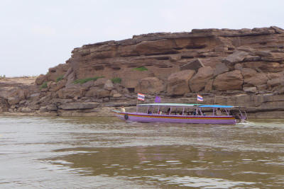
0703Isan1 Published caption : Looking on Google Earth, you may see that the section of the Mekong River running from Chanuman of Amnat Charoen down to Pho Sai of Ubon Ratchathani has several narrow portions flanked by either rock formations or sand dunes and beaches. Most of these geological features are submerged when the river is high, but become visible during the dry season (except on days when China releases huge amounts of water from its dams farther upstream). Many sites along this part of the Mekong have been promoted as tourist attractions. Some, such as Kaeng Khan Sung, are in Amnat Charoen, while others, including Hat Sai Sung, Hat Chom Dao, Hat Hong and Sam Phan Bok, are in Ubon.
|
|
Photo Descriptions

|
-
Recently searched
-
Recently viewed links
Did you find what you were looking for? Have you got some comments for us?